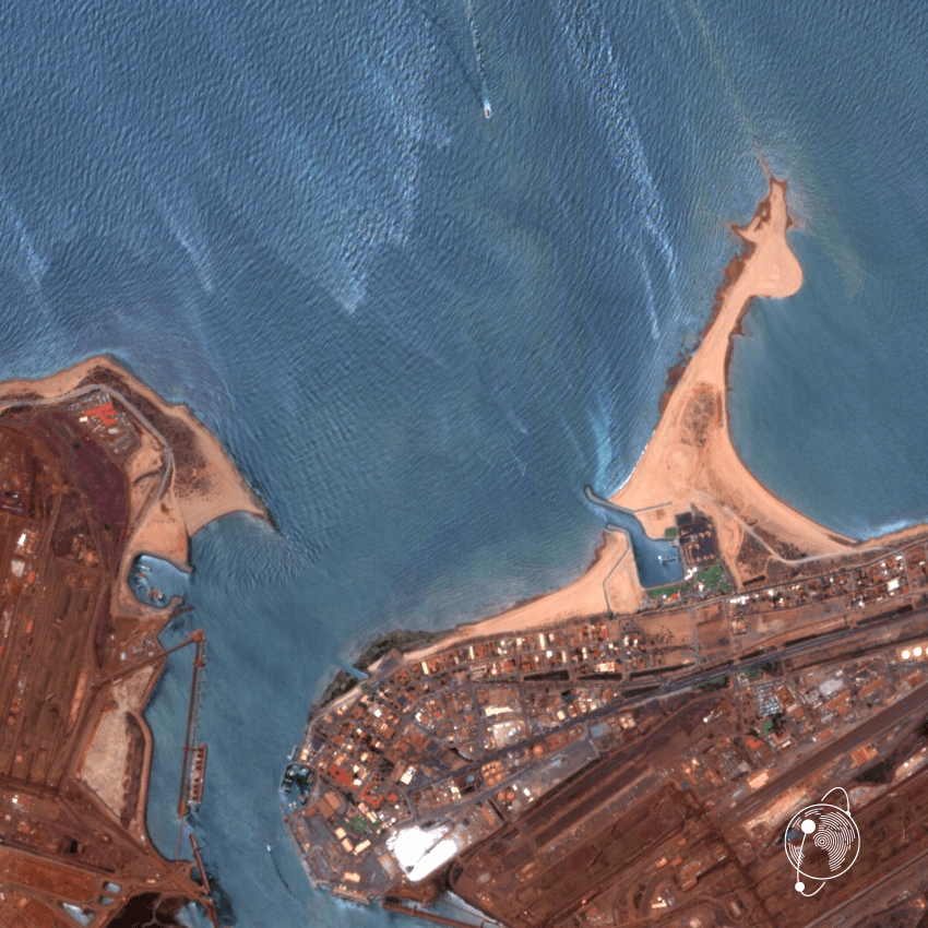
Port Hedland WA - ©EarthDaily
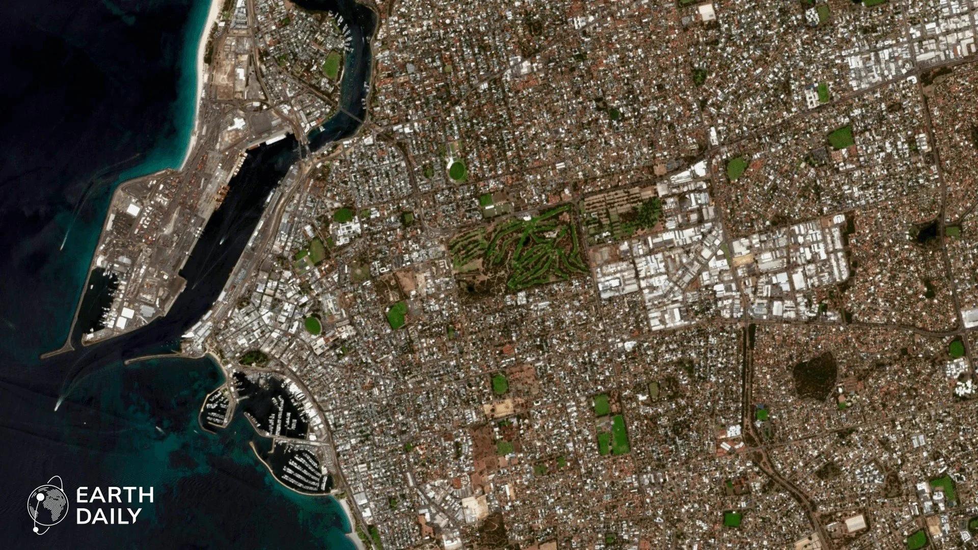
Perth, WA - ©EarthDaily
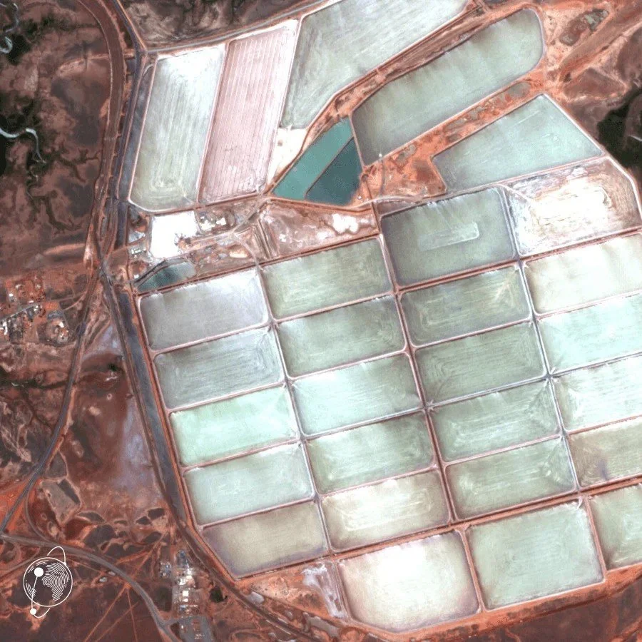
Port Hedland Salt Flats, WA - ©EarthDaily
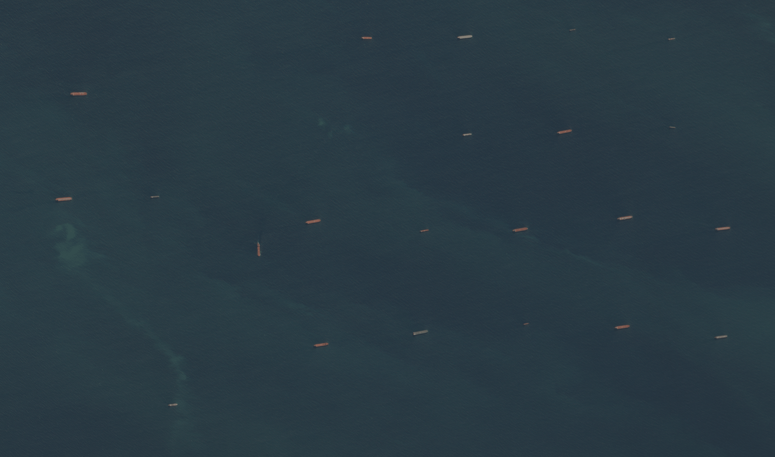
Port Hedland Ships - ©EarthDaily
Spotlight
Flagship Partner: EarthDaily
An interview with Paddy Brennan, Senior Director, Australia & New Zealand
There are many global EO events. Why was this specific moment in 2026 the right time for you to commit to the Australian community?
Two things came together this year.
Operations: 2026 is the year the EarthDaily Constellation goes from programme to woking system, with first imagery in February, six more satellites launched in May and commercial data availability beginning later this year. We can finally stand in front of this community with a flying system rather than a roadmap.
And the standard: in 2016, the last time Australia chaired CEOS, Analysis Ready Data was endorsed as a global standard in Brisbane, shaped largely by Australian agencies. Ten years on, Australia holds the Chair again, the future of ARD goes through the Plenary in Hobart, and in March our first constellation data products were certified against it, the first from any commercial optical constellation. Australia wrote the standard, we are delivering against it, in the same year and the same city.
For us there was not a better year, or a better week, to stand behind this community.
What are you excited about regarding the AEO Forum?
The room. Three hundred plus people from the agencies, research, industry, defence and the universities, for four days, once every two years. I am most interested in the people who turn data into decisions, the users and intermediaries, because that is where Earth observation either earns trust or does not. And I want to see more commercial operators inside the CEOS-ARD tent. A standard is only as strong as the breadth of operators who adopt it. We were the first optical constellation through that door this year and we would like company.
What specific need or opportunity are you most passionate about in Australia right now, and how does your work address it?
Cadence at continental scale
Australia is 7.7 million square kilometres with a small population and a thin ground network, so it depends on Earth observation more than almost any developed country. The public reference missions are superb, and Australia has built world-class national monitoring on them, but their cadence is measured in days to weeks. In-season agriculture, water, land management and recovery after fire and flood all need broad-area measurement that is frequent, consistent and comparable. A constellation designed to image the whole continent at the same time every day, at five metres, with the spectral depth to see vegetation, water, soil and heat, is the layer that has been missing. We are building it to sit on top of Landsat and Sentinel, not beside them.
Do you have a concrete example where your EO data or tech changed an outcome?
In mineral exploration, the clearest impact is changing where a company sends its field teams and its capital. Marigold combines analysis-ready data from public missions with spectral analytics so geologists can screen large tenements, map alteration and rank targets before anyone gets in a vehicle.
A concrete, public example: in November 2025 Odessa Minerals reported to the ASX that EarthDaily's spectral mapping of its Lyndon Project in Western Australia, using Sentinel-2, Landsat, PRISMA and EMIT data, had delineated 24 kilometres of prospective dolomite anomalies, identified several new base-metal targets and defined a nine-kilometre alteration anomaly prospective for gold. Odessa said the results allowed it to re-prioritise its field operations, redirecting mapping and sampling to the new targets.
For an ASX-listed explorer with a large landholding and a small team, that is the difference between a season spent looking and a season spent finding. And it was built on the public missions this community stewards.
Are you tackling an Australian-specific EO problem that you feel would benefit from more attention, and why?
Yes, and it is a problem of abundance. More commercial Earth observation streams are arriving every year, which is good, but it puts the burden on Australian users and intermediaries to work out what is fit for purpose. The answer is not for every agency and company to run their own evaluation. It is to pull more operators through the standard Australia helped write, and to make it worth their while. One idea I put to the Australian Space Forum in July is quality tiers within CEOS-ARD, radiometric and geometric, with a commercial incentive for providers to invest in calibration and validation and move up. Australia has world-class cal/val sites and expertise. If we want a trusted, interoperable market rather than a noisy one, this is the year to build it, with the CEOS Chair in Australian hands.
What's the best way for an attendee to connect with you at the Forum to explore collaboration?
Come and find us on the stand, or catch me after the opening plenary. I will be there all four days, as will colleagues from the team. The most useful conversation you can have with us starts with the decision you need to make, not the imagery you think you need. If it is a research collaboration, a data trial, a partnership, or you are an intermediary who wants to build on daily, science-grade data, we want to hear it. Before the Forum, LinkedIn or paddy.brennan@earthdaily.com both work.
What specific capability or resource are you bringing to AEO Forum 2026 that acts as the 'missing link' to unlock the next stage of Australia's sovereign capability?
A science-grade daily measurement layer that speaks the same language as the reference missions Australia already relies on. The constellation covers all of the Landsat and Sentinel-2 spectral bands and is cross-calibrated to them every day, so it slots into existing Australian workflows and archives rather than asking anyone to start again. The "missing link" is not a satellite, it is interoperability: data that meets the standard Australia helped write, delivered in the formats Australia's open data cube community built, at the cadence that the public missions were never designed to provide. Sovereign capability, in the sense that matters here, is Australia's ability to make its own decisions on trusted data, using Australian expertise and Australian intermediaries. We want to be the layer they build on.
What is a specific need or opportunity in the Australian EO environment, currently? What's missing?
Two things. The temporal dimension at continental scale, which is covered above. And a clearer route from a good commercial dataset to an Australian decision-maker's desk. Today that route runs through a small number of intermediaries and a lot of one-off procurement. The more the community standardises what "trusted" means and how it is bought, the faster commercial data turns into public value.
What's a problem you're stuck on where you'd love to partner with someone at this conference?
Making 22 bands a day useful to people who will never open a GeoTIFF. We are a data and intelligence company, not a domain expert in every Australian problem. The people who are, in water quality, in fire ecology, in broadacre agronomy, in mine closure, are at this Forum. We are looking for partners who take a consistent, calibrated time series and turn it into something an operator acts on.
Q10. We want this forum to drive real partnerships. What's one specific challenge you're facing right now?
We are a small team in a large region. EarthDaily's presence in Australia is a handful of people, and the constellation is about to make far more data available than we can carry to market alone. The challenge is partnerships, not technology: finding the Australian organisations that want to build on science-grade daily data and have the domain depth and the customer relationships to do it well.
What's something you do locally (in Australia) that gives you a unique advantage over global competitors?
Proximity to the people who carry Australia's rehabilitation liability. The first imagery the EarthDaily Constellation ever released, on February 19, 2026, was of Western Australia: Perth, where we are based, and Port Hedland, the gateway for the Pilbara's iron ore. Western Australia pairs some of the world's largest mining operations with one of its most demanding closure regimes. Every operator has to show, over decades, that disturbed country is being returned to a stable state, and much of that evidence is still gathered once a year and by hand. A consistent, calibrated daily record of clearing, water and vegetation recovery, with partner radar watching tailings and slopes for movement, turns rehabilitation from an annual argument into a measured trajectory. Global competitors image Australia. We started here. We live with the regulator, the miners and the landscapes, and we build for what they have to prove.
If you could remove one misconception about your company or the EO industry, what would it be?
That sharper pixels mean better decisions. Resolution is one dimension of Earth observation, and for many problems it is not the limiting one. Consistency is. If two images of the same field, taken a week apart, differ because of the sun angle, the sensor or the processing, then the change you see is not the change on the ground. Measurement means the same thing, every time, so the difference is real. That is a much harder engineering problem than a big aperture, and it is the one we chose to solve.
Q13. Looking 3 to 5 years out, what are you working on now that will change how Australia uses Earth Observation? What role will the AEO Forum community play in making that happen?
The full constellation: the whole of Australia measured every day, at five metres, across 22 bands, at science grade, cross-calibrated to the missions this community already trusts. That turns Earth observation from a periodic survey into a continuous measurement system, and it makes the next layer possible: foundation models trained on consistent daily time series rather than on whatever happened to be captured. The AEO Forum community's role is the part we cannot do. Standards, cal/val, the domain science, the intermediaries who turn a time series into a decision, and the workforce that will use it. Australia is chairing CEOS this year and endorsing the future of Analysis Ready Data in Hobart. If this community keeps setting the bar, the industry will keep clearing it.
What are you bringing through your Flagship commitment that will help the Australian community reach its goals sooner or more effectively than it could on its own?
Perspective, platform and company.
Perspective first. We are a Canadian company with a global constellation, and from the outside it is obvious what this community gives the world, and easy to forget from the inside. The Analysis Ready Data standard the whole industry now works to was endorsed in Brisbane in 2016, with Australian agencies doing much of the work. The Open Data Cube that began as the Australian Geoscience Data Cube now underpins Digital Earth Africa and Digital Earth Pacific. Australia chairs CEOS this year and will take the future of ARD through the Plenary in Hobart. A country of 27 million wrote the rules a global industry builds to, and a commercial operator from the other side of the planet certified against them this year. That is worth saying loudly, and a Flagship Partner from outside the country can say it without it sounding like self-congratulation.
Platform: we have used the Flagship position to help shape a plenary that puts agency and commercial voices together on trust and standards in the CEOS Chair year, rather than taking a sponsor slot.
Company: we have been encouraging other commercial operators to join the CEOS-ARD community and to be in Hobart, because the standard is stronger with more of us inside it.